Arader Galleries
Sitvs Terræ Circvlis Coelestibvs Circvndatæ
Pickup currently unavailable
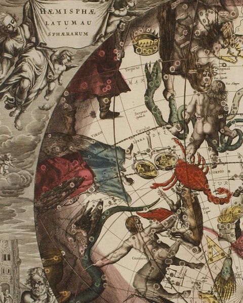
Plate 11 – Sitvs Terræ Circvlis Coelestibvs Circvndatæ
From: Atlas Coelestis seu Harmonia Macrocosmica
Amsterdam: Schenk and Valk, 1708
Hand-colored copperplate engraving
36 1/2” x 32" framed
This plate is enjoyable to look at for its simple geometric center, surrounded by an intricate surrounding of clouds and cherubs. The multiple latitude and longitude lines play interestingly with the concentric circle around the Earth, which intersects the Horizon line and accompanies a detailed and decorative tilted zodiac belt.
The image depicts the location of the Earth with reference to the Celestial circles. The locations depicted on the earth are: the Eastern Part of Asia, the Indian Ocean (MAR DI INDIA), the Northern Polar Sea (MARE TARTARICUM), Australia (NOVA HOLLANDIA), The pacific Ocean (MAR DEL ZVR), The North-Western part of North America and the unknown South Land (TERRA AVSTRALI INCOGNITA)
The plate is composed so that there is a 45 degree North Horizon circle for the viewer. The Zenith is the point on the Celestial Sphere directly above the viewer and the Nadir is the point on the celestial sphere directly below the viewer.
Other relevant points displayed on the map are: The Meridian Line (COLVRVS SEV MERIDIANVS SOLISTORVM), North (SEPTENTRIO), East (ORIENS), South (MERIDIES), and West (OCCIDENS)
There are two figures in the bottom of the print, outside of the large center image. The female on the bottom left refers to Astrology and the one on the right refers to Astronomy.

