Arader Galleries
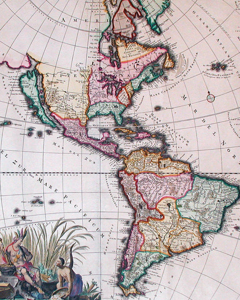
Pacaart vertoonende de Zeecusten... by Hendrick Doncker (1626-1699)
Pickup currently unavailable
Hendrick Doncker (1626-1699)
Pacaart vertoonende de Zeecusten von Chili, Peru, Hispania Nova, Nova Granada, en California
From De Zee-Atlas ofte Water-Waereld
Amsterdam, 1659
Hand-colored copperplate engraving
32 x 36" framed
$12,000
This handsome chart of the west coast of North and Central America was one of the earliest regional maps to focus on the Pacific Coast. It was published by Hendrick Doncker, one of the most active map publishes in Amsterdam during the second half of the seventeenth century. Doncker was the first to follow Arnold Colom with a comprehensive marine atlas, issuing the first edition Zee-Atlas.
Oriented with north at left, this striking map is one of the most extreme representations of the famous cartographic myth of California being an island, and also depicts California on a larger scale than any earlier charts. The depiction is based upon Sanson's maps of 1656, with even greater sea dividing the ersatz island of California from the mainland. There is excelent detail throughout the Pacific Coast. The Canal de Santa barbara, Monte Rey, P. Concepsion, San Diego, Mendocino, San Quentin, C. Blanco, and many other early place names appear. Three inset maps within decorative strapwork boarders are shown in the upper left, including the discoveries of Abel Jansz Tasman in New Zealand, Maeten Gerritz Vries's voyage around northern japan, and the Ladrones islands in the Pacific. This particular map is a rare first-state example, even more noteworthy for its magnificent full original color.
The Zee-Atlas continued to be issued, appearing as late as the early 1700s at the hand of Doncker's son Hendrick, Jr., who continued the business following his father's death in 1699. The rarest example of the famous California map from Doncker's Zee-Atlas remains the 1659 first edition, here in superb condition, at the highest level of quality color and impression.


