Arader Galleries
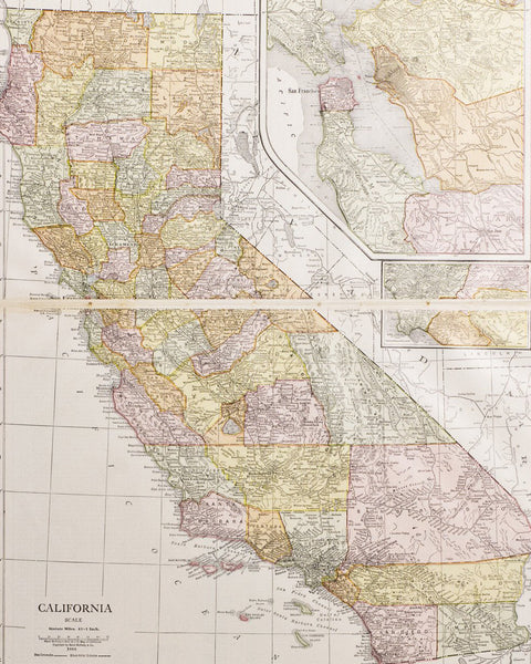
California with insets of Southern & Central Regions (1916)
Pickup currently unavailable
Rand McNally
California with insets of Southern & Central Regions
From: New Imperial Atlas of the World
Chicago: Rand McNally & Co. Publishers.,1916
Hand-colored Lithograph
Sheet Dimensions: 11.5 x 14.25 in
This beautifully colored map of California with insets of Southern & Central regions includes the counties of Los Angeles, San Bernadino, San Diego and Riverside. Along with the Greater San Francisco Bay, covering the Sonoma-Napa Valley to Merced.
Topographical details of the Sierra Nevada and San Bernadino Mountains, as well as other mountain ranges in neighboring states.
A legend of California counties, chief cities and population count are included.


