Arader Galleries


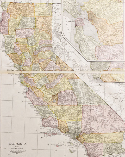
Map of Amador County, California
$ 7,500.00
Pickup currently unavailable
Mutual Lithographic
Map of Amador County, California
San Francisco, 1904
Lithograph
60” x 40”
A very detailed county map with 7 insert maps of towns, all important for their gold mines and being the focus points of new wealth and population, which in 1850 allowed early statehood for California.
This maps’ contents were mandated by the federal general land office, as each county Surveyor nationwide was responsible for creating a complete and updated land ownership map for his area , to be filed within their state annually 1895-1925 est., for the state to then file with the GLO of the fed, providing a compete overview of the breakdown of private and public property, held within the United States.
This area is in the center of the California gold rush , started in 1849, it continued in this area until 1855-56, then again in the 1920’s when gold prices soared.
This issue was printed by Mutual Lithographic in SF and comes from the collection of retired dealer John Coll; a great rarity in fine condition.