Arader Galleries
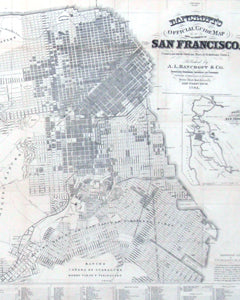
Map of the City and County of San Francisco
Pickup currently unavailable
C.L. McEnerney (1874-Unknown)
Map of the City and County of San Francisco
San Francisco, 1908
Paper mounted on linen, rolled
80” x 62”
This large Map of the City and County of San Francisco is clearly and simply rendered in blue ink. The map has been printed under C.L. McEnerney C.E. in 1908. While who C.L. McEnerney was remains a mystery the map provides fascinating insight into San Francisco’s early history.
This map documents the rapid re-growth of San Francisco in 1908. All streets are planned and laid out in tight grids. The Financial district is clearly growing with a dense series of streets stemming off Market Street. The Sunset District is still being settled as only some of the streets have been named. The municipal railway was not initialized until 1909 allowing citizens’ easier transportation access from the downtown area to areas by the ocean.


