Arader Galleries
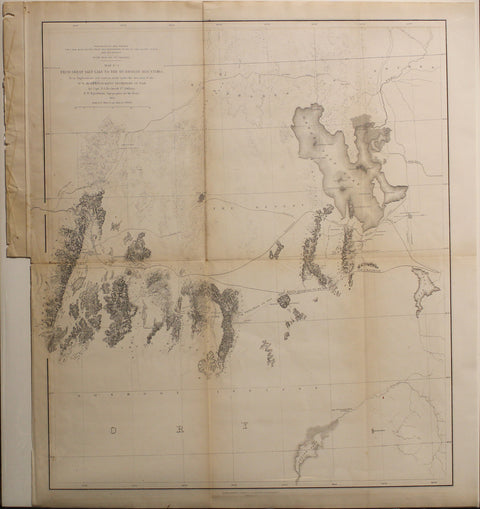
Beckwith and Egloffstein. Map No. 2 From Great Salt Lake to the Humboldt Mountains. 1856.
$ 250.00
Pickup currently unavailable
E.G. Beckwith (1818–1881) & E.W. Egloffstein (1824–1888)
Map No. 2 From Great Salt Lake to the Humboldt Mountains
From U.S. Pacific Railroad Surveys, Washington, D.C., 1856
Hand-colored lithograph
Sheet size: 20.5 x 18 inches
This detailed map represents a segment of the U.S. Pacific Railroad Surveys, a series of explorations commissioned by Congress to determine the most practical and economic route for a transcontinental railroad. Conducted under the direction of Secretary of War Jefferson Davis, this particular survey was led by Captain E.G. Beckwith, with topographical work by E.W. Egloffstein, whose innovative shading techniques conveyed elevation with remarkable precision. The map traces the route from the Great Salt Lake westward to the Humboldt Mountains, documenting the rugged terrain, water sources, and key geographic features critical for railway planning.
A significant cartographic achievement, the Pacific Railroad Surveys were instrumental in shaping westward expansion, influencing settlement patterns and transportation networks. This map exemplifies the federal government's commitment to infrastructure development in the mid-19th century, providing invaluable insights into the American West’s geography. Elegantly detailed and historically important, this example is a fine addition to any collection focused on U.S. exploration and rail history.