Arader Galleries
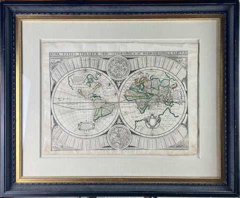
Melchior Tavernier. Nova totius terrarium orbis. 1643.
Pickup currently unavailable
Melchior Tavernier (1564-1644)
Nova totius terrarium orbis geographica ae
hydrographica tabula
Copperplate engraving with original outline color Paris,
1643
16 7/8" x 22 7/8" sheet, 28 1/4" x 34 1/4" framed
Melchior Tavernier was from a large family of publishers working in Paris during the early years of the seventeenth century. He is probably best known for his publication of a map of the Post Roads of France which was copied many times until the end of the century. However, he also issued several other maps and atlases,
including this one, which replaced his 1630 world map, closely copied from Jodocus Hondius' prototype of 1617.
In this particular map, Tavernier revised both the northwest and northeast coastlines of North America but failed to make any reference to Australia. The double hemisphere is surrounded by four small scenes showing the elements symbolized by an eagle, a salamander, land animals and a while. Other information contained
on the map includes celestial circles and two large banners, above and below the double hemisphere, laying out the equivalents of degrees in both French and German miles.
In common with the copies held at the British Library and the Biblotheque Nationale, the lower left cartouche is entitled Carte de l'Amerique and acknowledges the authorship of Tavernier while the lower right cartouche remains blank.

